
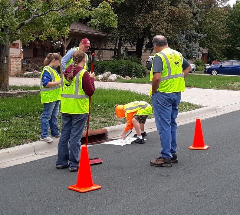
Lakes are monitored by Prior Lake – Spring Lake Watershed District staff and volunteers for water level, lake chemistry, ice over & ice out dates, and aquatic vegetation. This provides important information to determine what actions must be taken to keep our lakes enjoyable.
Lake Level Monitoring
Lake level is recorded in two ways: by staff gage and automated level logger. Lakes with staff gages are recorded by District staff at least bi-weekly and used to calibrate the automated level loggers. Automated level loggers record the water level every 15 minutes from ice-out to ice-in. Prior, Spring, Fish, and Pike Lake level loggers are linked to computer servers to display current data on the PLSLWD website.
Lake Profile (Chemistry) Monitoring
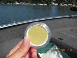
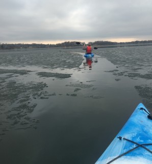
PLSLWD contracts with Three Rivers Park District (TRPD) to monitor watershed lakes. Biweekly samples are collected from the surface (epilimnion), middle (thermocline), and bottom (hypolimnion) of the lake. By collecting profile data, the District is able to better determine if a lake is receiving large amounts of nutrients from internal sources. TRPD collects field and chemistry data and the chemistry samples are analyzed at the TRPD lab.
PLSLWD has compiled water quality report cards for many of the District’s lakes. You can find the reports on the individual waterbodies page for each lake or view all of the lake report cards here.
Physical Field data collected includes:
- Temperature
- pH
- Dissolved Oxygen
- Conductivity
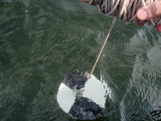
- Clarity/Secchi depth
Chemistry data collected includes:
At Surface (Epilimnion)
- Total Phosphorus
- Soluble Reactive Phosphorus
- Total Nitrogen
- Chlorophyll a
- Chlorides (monthly)
Middle (Thermocline)
- Total Phosphorus
- Soluble Reactive Phosphorus
Bottom (Hypolimnion)
- Total Phosphorus
- Soluble Reactive Phosphorus
- Chlorides (monthly)
Community-Assisted Monitoring Program (CAMP)
The Community-Assisted Monitoring Program (CAMP) is a cooperative program with the Metropolitan Council that engages volunteers on lakes around the state to gather water quality data. This data is used by cities, counties and other government entities to determine the most efficient way to treat impaired waters and maintain good water quality. Currently the Prior Lake – Spring Lake Watershed District has CAMP volunteer monitors working on eight different lakes: Buck Lake, Haas Lake, Cates Lake, Prior Lake, Fish Lake, Crystal Lake, Little Prior Lake and Sutton Lake. The volunteers learn various techniques to gather information on water quality. They record:
- Water temperature
- Secchi disc readings
- Recreational suitability
- Weather: cloud cover, wind, air temp
- Aquatic plants present
- Lake level
- Physical appearance: color, surface type, odor
- Physical condition (clear, some algae, high algae color, etc)
- Unusual conditions (storms, high winds, rain, chemical applications)
Water samples are collected for total phosphorus and Kjeldahl nitrogen, chlorophyll-a. The volunteers also gain increased awareness of their lake’s condition.
The CAMP runs from April through October. Monitoring is done on a bi-weekly basis and samples are picked up by the Metropolitan Council once a month. Contact Danielle Studer if interested: dstuder@plslwd.org or 952-440-0069.
There are many other options for people interested in volunteering with the District. Visit our Volunteer Opportunities page for more ideas.
Ice-Over & Ice-Out
Ice-Over and Ice-Out data has been recorded for some lakes since as early as 1963. Volunteers call or email PLSLWD staff in winter when 90% of the lake has frozen and when 90% of the lake ice has melted in the spring.
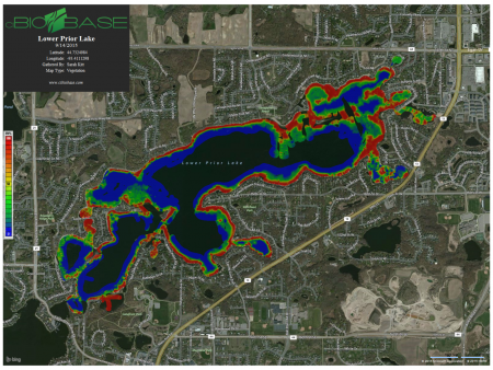
Automated Vegetation Density Mapping (BioBase)
BioBase uses sonar to detect a lake’s depth, bottom hardness, and vegetation density. This information may help influence management decisions within the district. Mapping is done in the spring, summer and fall to record each stage of the aquatic plant lifecycle.
Two questions that the District is using the BioBase data for are: How effective are treatments for aquatic invasive species? And how does vegetation density correlate to water clarity?
Before and after maps can be created to analyze how effective curlyleaf treatments were. In 2015 for example, the District received credit from a treatment contractor after maps proved treatment had been ineffective in some areas. These funds were put into the 2016 treatment for curlyleaf pondweed.
For more detailed information read the full report: