
Quick Facts
Ordinary High Water Level*
Prior Lake 903.9 feet, Spring Lake 912.8 feet
Watershed Area
42 square miles
Connectivity to other waterbodies
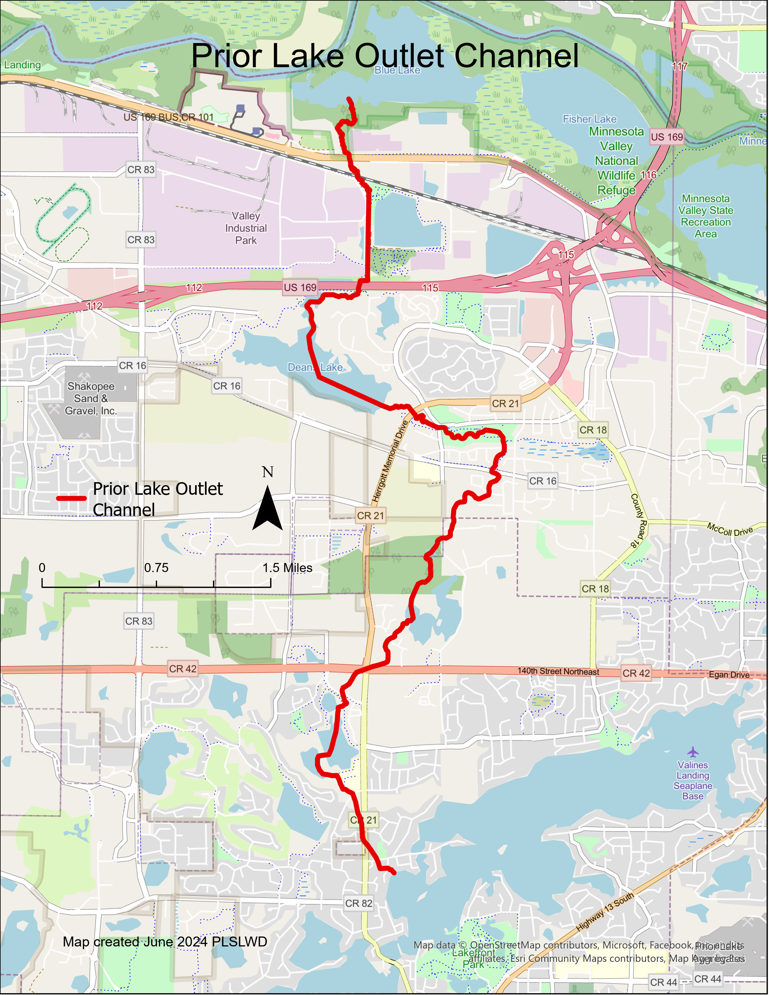
PLOC is seven miles long, and started at Lower Prior Lake and discharges into the Minnesota River in Shakopee
History of the Outlet Channel
In 1973, citizens first petitioned the Prior Lake-Spring Lake Watershed District to construct a stormwater outlet from the landlocked Prior and Spring lakes. That year, a feasibility study concluded that a pipe outlet should be constructed as a relief valve to carry approximately 50 cubic feet per second of water downstream and areas should be acquired and reserved for ponding purposes. Due to numerous complications, the outlet structure and outlet channel were not completed until July 1983, ten years after the initial citizen petition. Unfortunately, two 100-year storm events occurred in March of that year, before the Channel was completed. Spring Lake Dam was sandbagged, and homes were flooded. Spring Lake Dam has only had to be sandbagged twice since then, in 1993 and 2014.
Journey to the Minnesota River
The outlet channel leaves Lower Prior Lake through the outlet structure on the southwestern side of the lake, beginning its seven mile journey to the Minnesota River through a quarter mile underground pipe.
The pipe outlets in a wetland near Jeffers Pond Elementary and travels north through Jeffers Pond. The channel then travels under County Road 42 and flows north through Pike Lake. The channel continues to flow north, eventually passing through Dean Lake before completing its northward journey and emptying into the Minnesota River via Blue Lake near Valleyfair.
Outlet Structure Improvement – 2010
Normal wear and tear on the outlet structure resulted in cracking to the structure and diminishing efficiency. In 2007, partners and advisers developed a strategy and plan for updating the outlet system called the Multi-year Outlet and Channel Improvement Project.
The outlet structure was replaced in 2010, with an accordion-shaped fixed crest weir and a low flow gate, allowing manual discharge of water between 902.0 feet (with a permit from the DNR for March-April) and 902.5 feet.