Pike Lake
DNR Lake Number: 70007600
Public Boat Access: Canoe/kayak access planned for Pike Lake Park on the west side of the lake.
Quick Facts
Surface Area
50 acres
Ordinary High Water Level*
820.5 feet above sea level
Average Depth
7 feet
Watershed Area
21,770 acres
Maximum Depth
9 feet
Connectivity to other waterbodies
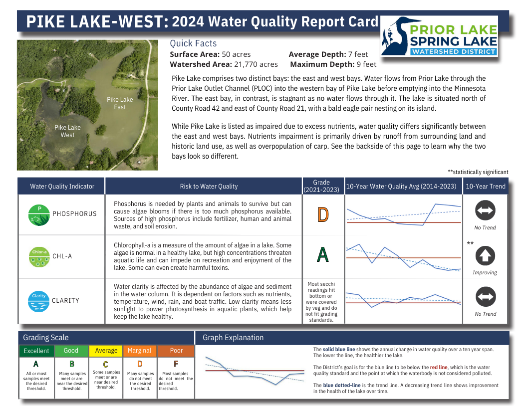
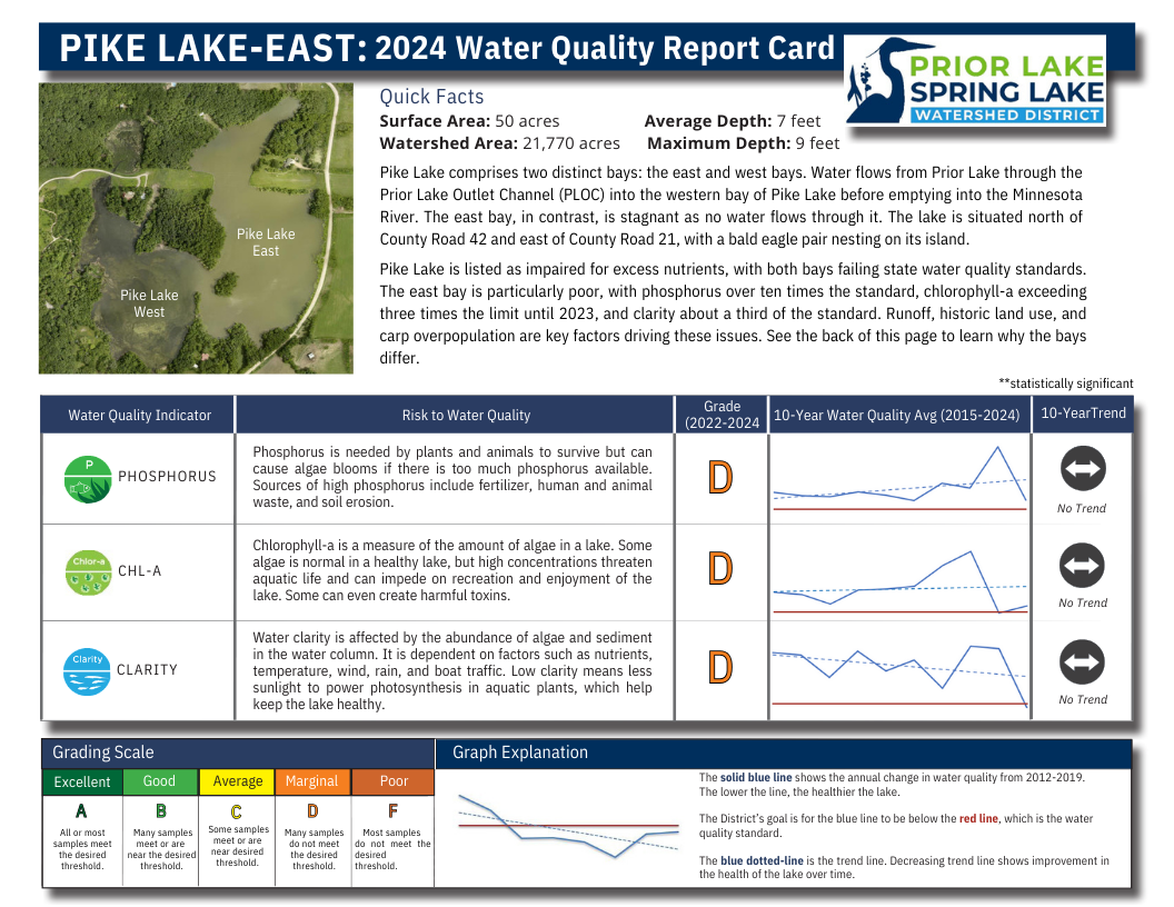
The Prior Lake Outlet Channel (PLOC) flows north through Pike Lake on the way to the Minnesota River. The PLOC flows into Pike Lake from Jeffers Pond.
Impairment Status
Impaired for nutrients. TMDL study in progress.
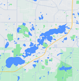
Maps
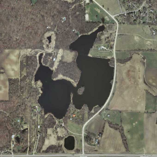
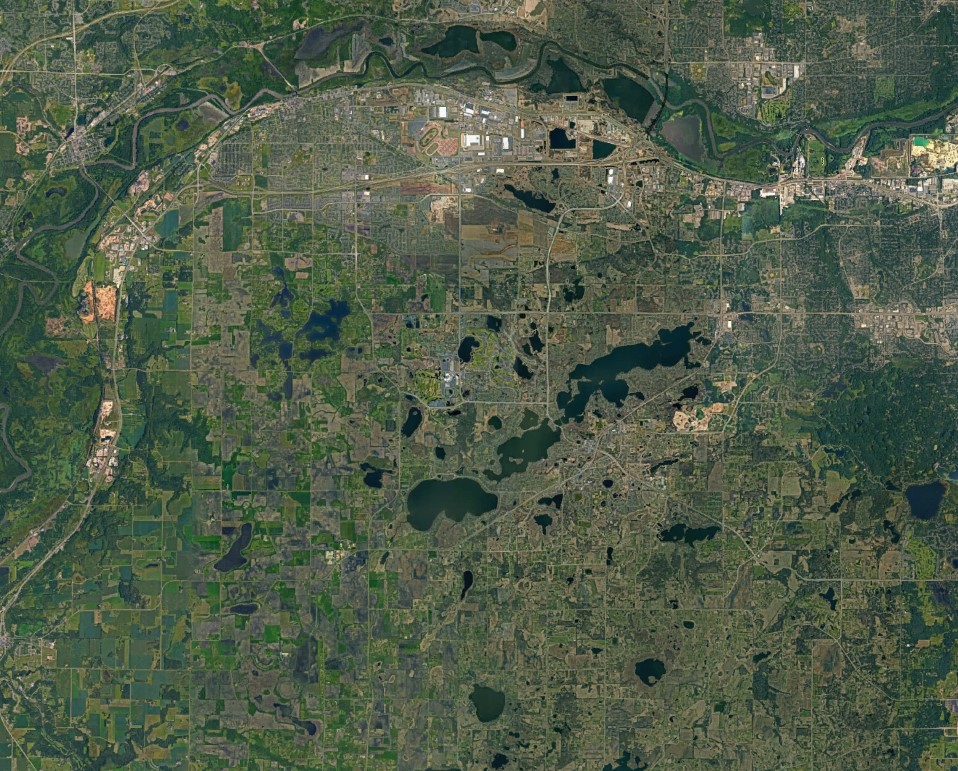
Other Maps
Water Quality
Click on each image below to view in a larger size
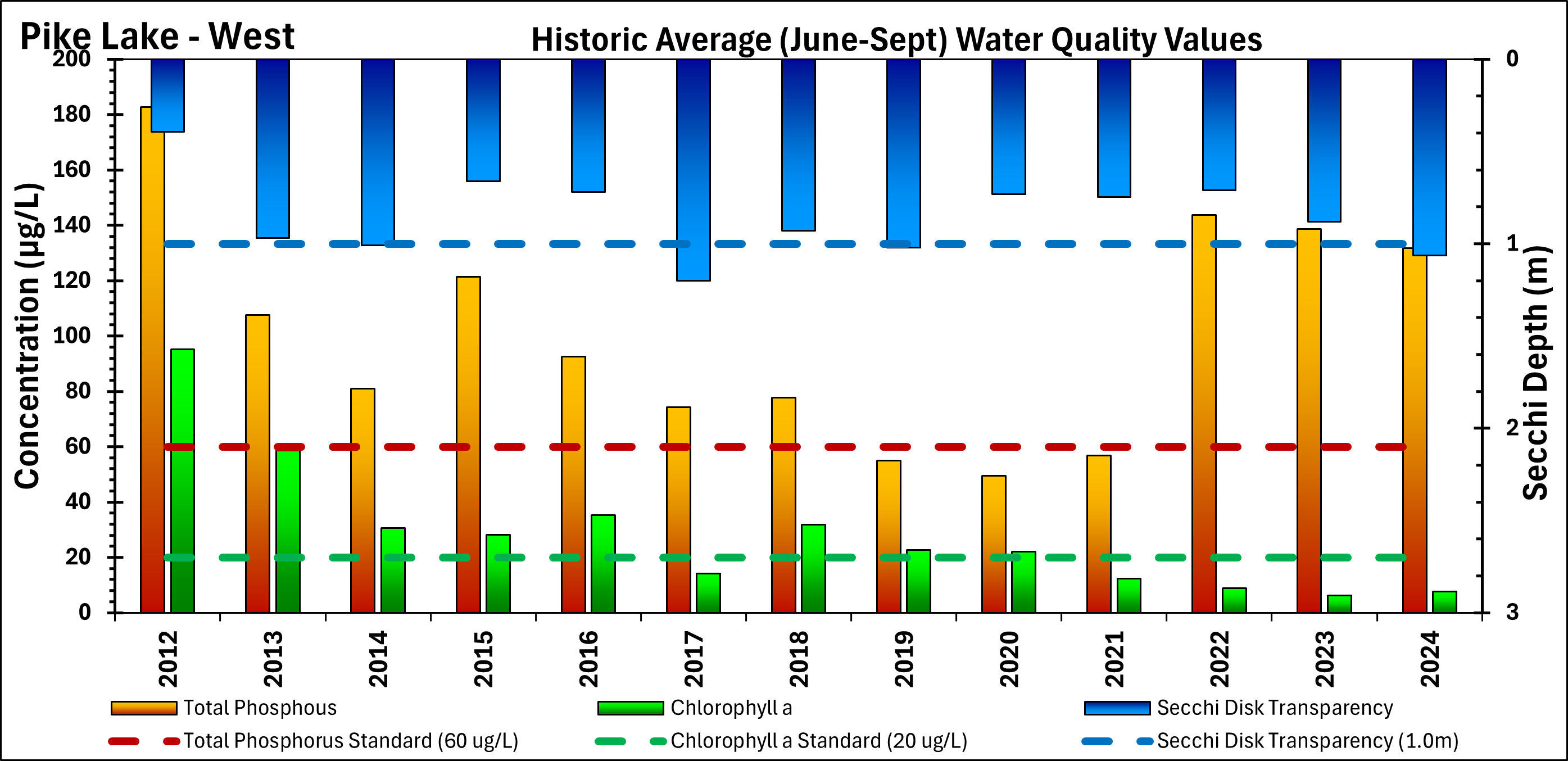
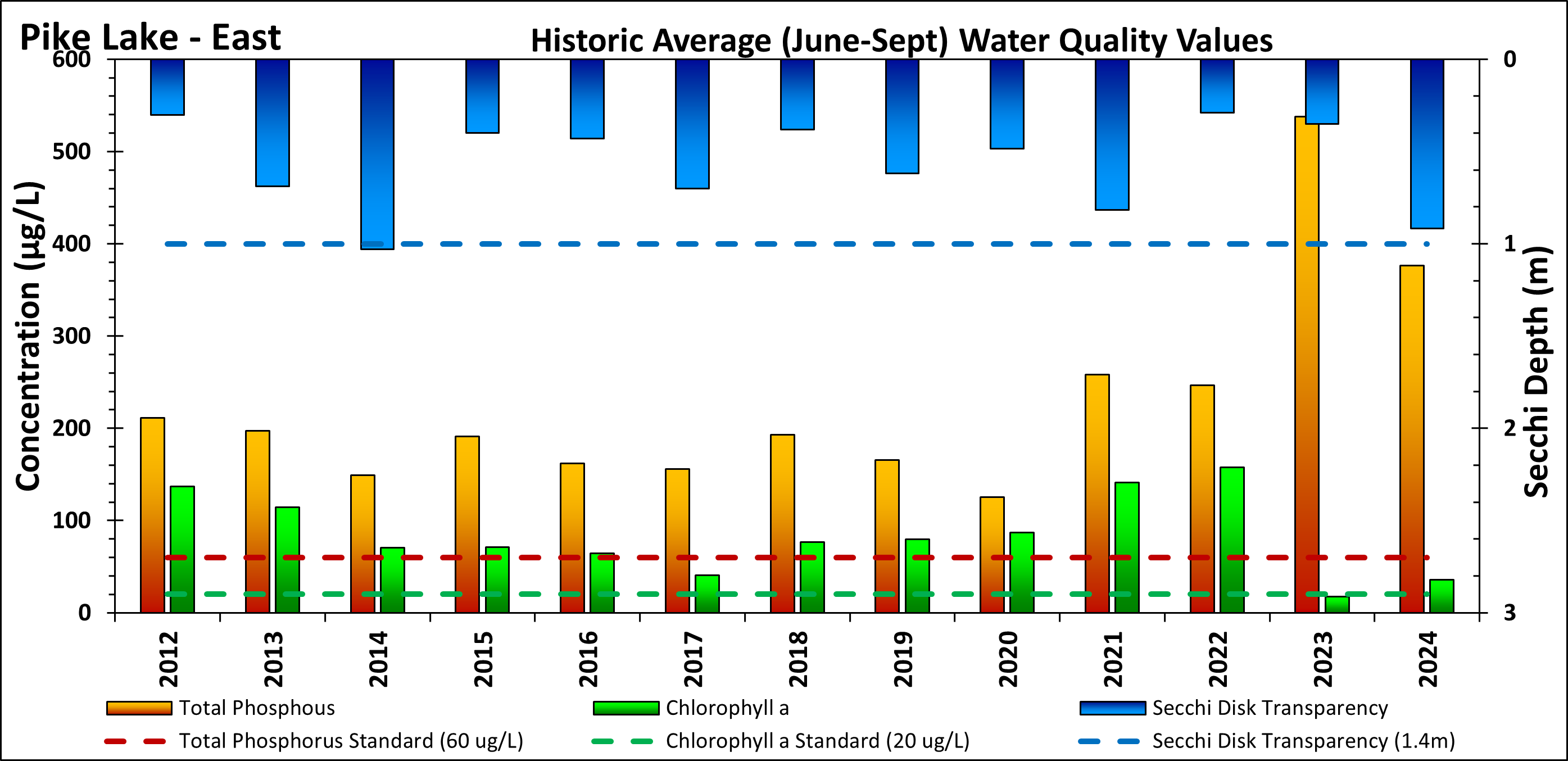
These graphs represents the annual averages of water quality parameters between June 1 and September 30.
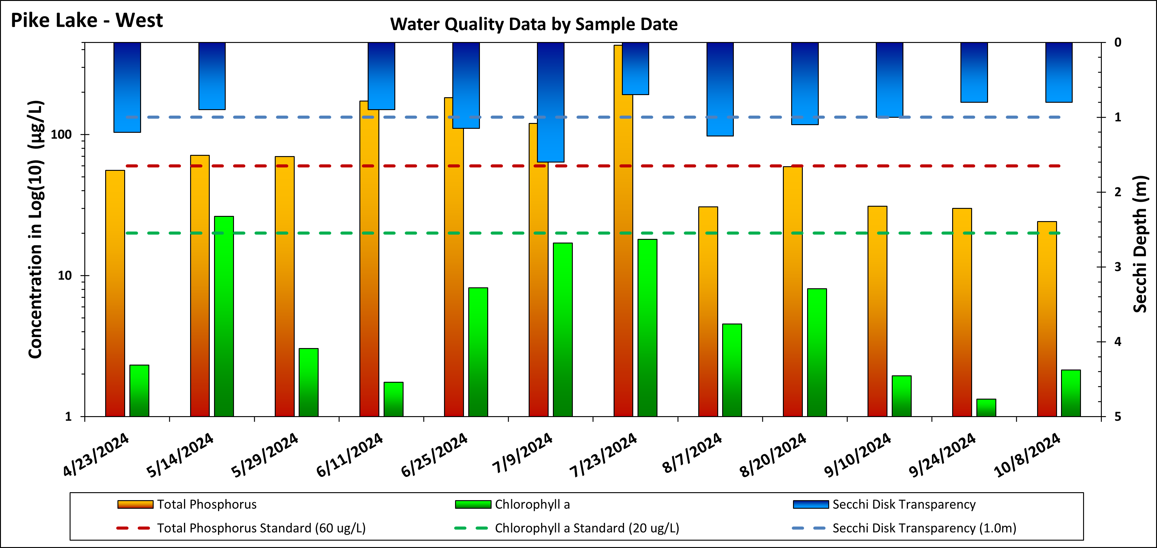
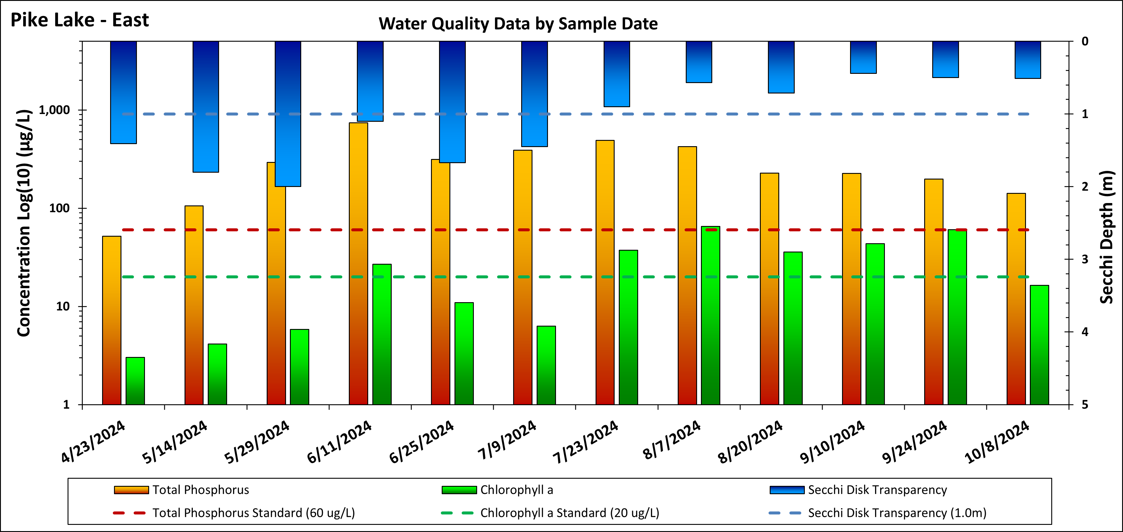
These graphs show water quality parameters on specific dates in 2024.
