

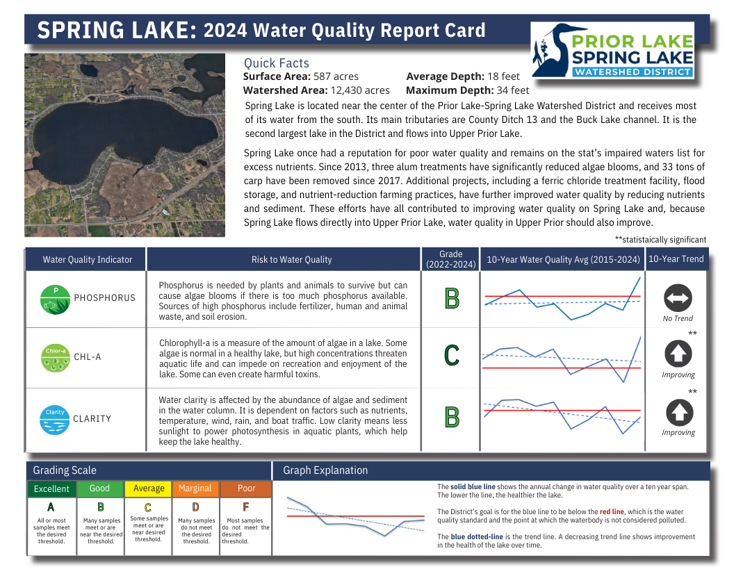
Spring Lake
DNR Lake Number: 70005400
Public Boat Access: Vergus Ave (southwest corner of the lake)
Quick Facts
Surface Area
587 acres
Ordinary High Water Level*
912.8 feet above sea level
Average Depth
18 feet
Watershed Area
12,430 acres
Maximum Depth
34 feet
Connectivity to other waterbodies
Flows north into Upper Prior Lake. Receives the water which drains from the primarily agricultural upper watershed, including County Ditch 13 and the Buck Lake watershed.
High Water No-Wake Restrictions
When lake level exceeds 912.8 feet*
Impairment Status
Impairments for Excess Nutrients,** Biota,*** and Mercury****
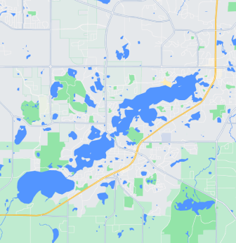
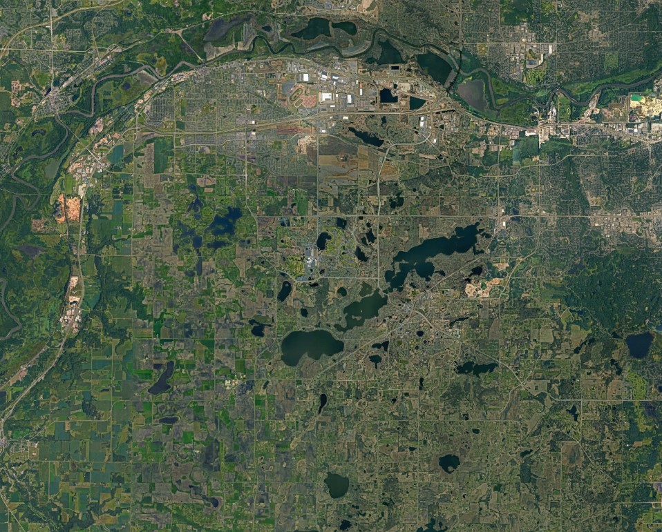
Maps
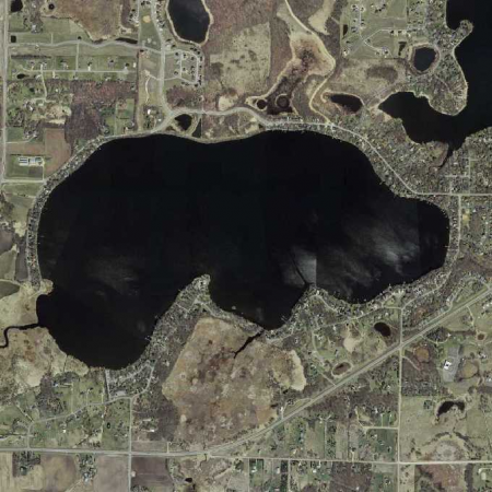
Other Maps
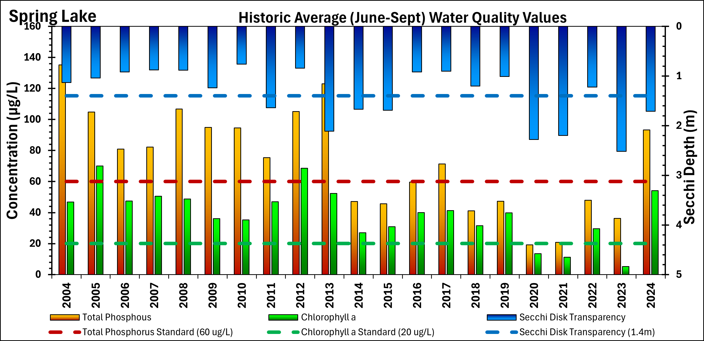
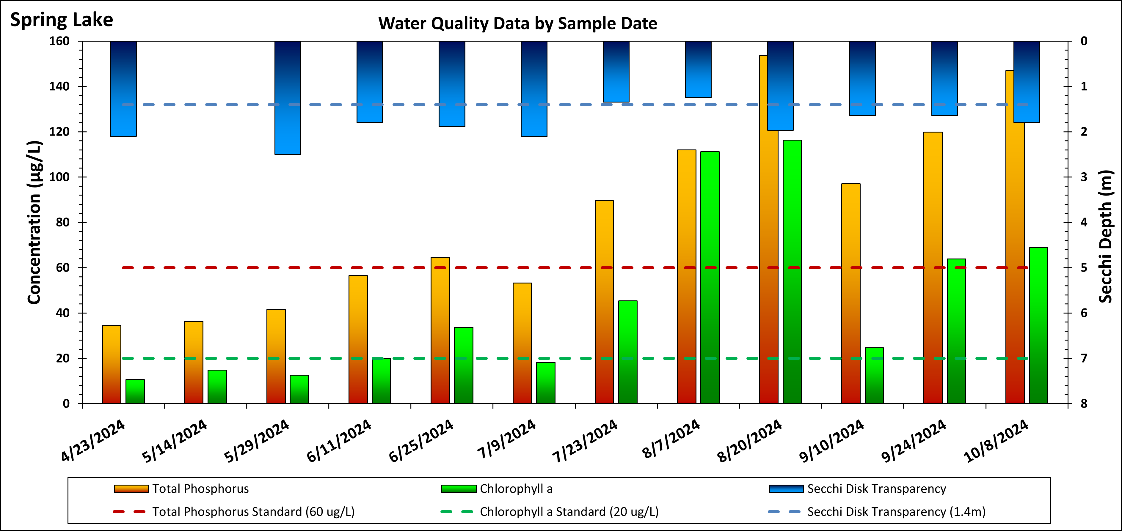
Water Quality

This graph represents the annual averages of water quality parameters between June 1 and September 30.
This graph show water quality parameters on specific dates in 2024.
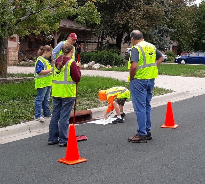
Related Resources
Ongoing Projects
Completed Projects
*No-Wake restrictions are set by the City of Prior Lake and enforced by the Scott County Sheriff. Once high water levels have subsided and remained below the no-wake level (912.8 ft) for 72 hours, no-wake restrictions will be lifted. For more no-wake details, see the full city ordinance.
**See the TMDL study for more information.
***Biota impairments are not handled at the local government level. The State of MN addresses impaired biota by examining the interactions of numerous physical, chemical, and biological processes that define community composition. Biological impairments can be driven by natural or unnatural changes to one or many components of these systems. Biological impairments differ from some traditional water quality impairments in that the impaired biotic communities are indicators of disturbance rather than causes of disturbance. Biological impairments are commonly caused by stressors that are not considered conventional pollutants. These include stressors such as degraded habitat or altered hydrology. Minnesota utilizes the process of stressor identification developed by the EPA to identify the dominant stressors.
**Mercury impairments are not handled at the local government level. The State of MN has a TMDL they are following here.